Central Minnesota River Watershed Partnership

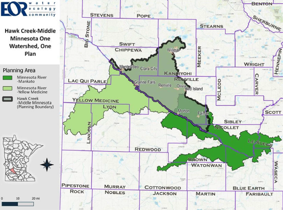
The Hawk Creek-Middle Minnesota Comprehensive Watershed Management Plan (HCMM CWMP) also referred to as the "Plan", represents over two years of collaborative work between six entities that have sought to understand, improve, and protect the surface and groundwater resources of the region. The planning area ( displayed in the map on the following page) encompasses five counties (Chippewa, Kandiyohi, Nicollet, Renville and Sibley) and is nearly 1,262 square miles. It is home to three watershed zones that encompass both high-valued recreational lakes and streams, as well as many impaired waters impacted by intensive row crop agriculture and increased sediment and pollutants transported by rainfall. These waters drain to the Minnesota River, one of ten major river basins in Minnesota, and then ultimately to the Mississippi River.
The land use and climate-related issues identified in this Plan are not unique to the Hawk CreekMiddle Minnesota planning area, and in fact, affect the health of watersheds throughout the Upper Midwest. Addressing these challenges will require a new way of thinking and a strong commitment from private landowners, local municipalities, and government agencies alike.
The Hawk Creek-Middle Minnesota Partners responsible for this Plan development include Chippewa, Kandiyohi and Renville counties, along with each county's respective Soil and Water Conservation District. With the approval of this Plan by the Minnesota Board of Water and Soil Resources (BWSR) local government units that adopt the Plan will meet minimum eligibility requirements for state funds for the implementation of projects and programs needed to achieve the restoration and protection goals included in this Plan.
Click below to view the plan for the Central Minnesota River Watershed Partnership:
Nov-10-2021_CMRWP_Plan-Only.pdfNov-10-2021_CMRWP_Appendices-Only.pdf